BTT Cruz de la Ceja-Fuente El Pino
Very pleasant route, a 23 km ‘stroll’, ideal for gravel and gentle mountain biking. Without significant slopes, tracks in good
Very pleasant route, a 23 km ‘stroll’, ideal for gravel and gentle mountain biking. Without significant slopes, tracks in good
With this route, you can explore the mountains of the Macizo del Caroig and the Muela de Cortes by bike.
Pay attention to the +1245 meters of elevation gain for less than 30 km. The first part offers spectacular views
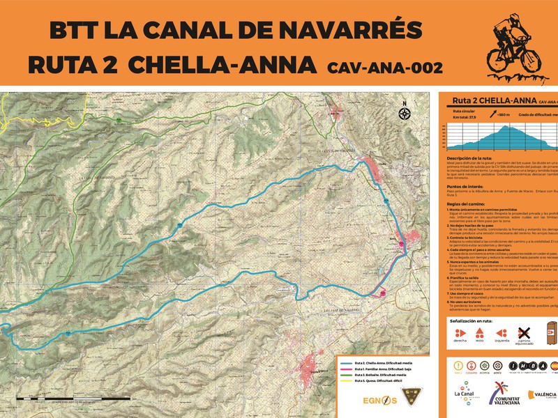
Tour around the entire area of Chella. The first half goes through the eastern part until Km 8, where it
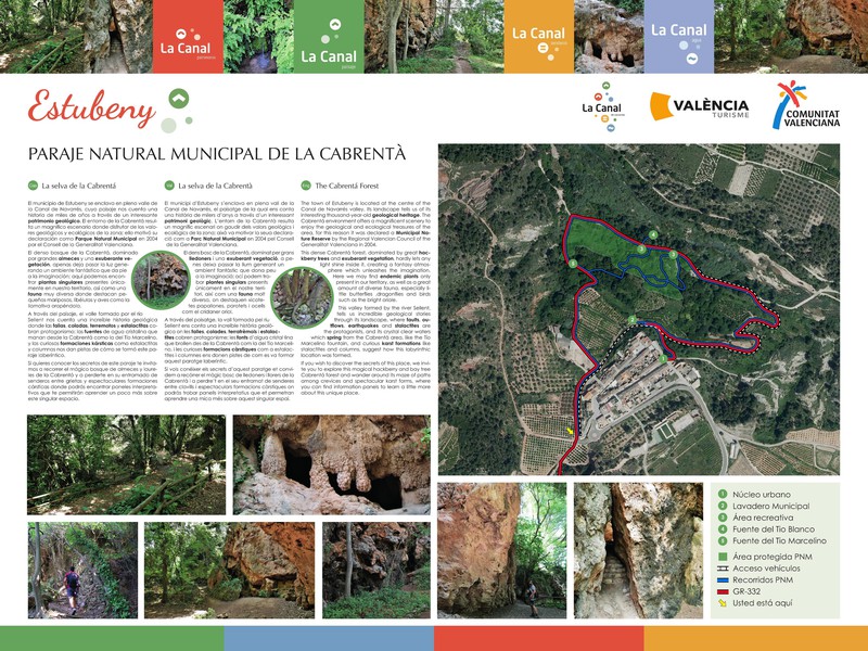
Start: Mirador del Río / Easy / 1:30h. Circular La Cabrentà or Selva de Estubeny is located in the small
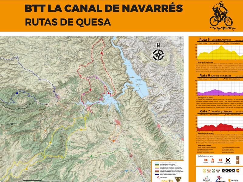
– Start: Quesa. End: Quesa – Circular: Yes Direction: Clockwise. Can it be done counterclockwise: Not recommended. – Km technical

– Start: Quesa. End: Quesa – Circular: Yes Direction: Clockwise. Can it be done counterclockwise: Not recommended. – Km technical

– Start: Quesa. End: Quesa – Circular: Yes Direction: Clockwise. Can be done counterclockwise: Yes – Technical path or trail
CAV-NAV-004 – Start and finish: Option 1: Playamonte recreational area (Navarrés) (https://goo.gl/maps/snv5ubk9pnQGMZ7J9) Option 2: Navarrés. (https://goo.gl/maps/io44DiefrrpFBXP99) – Circular: Yes Direction:
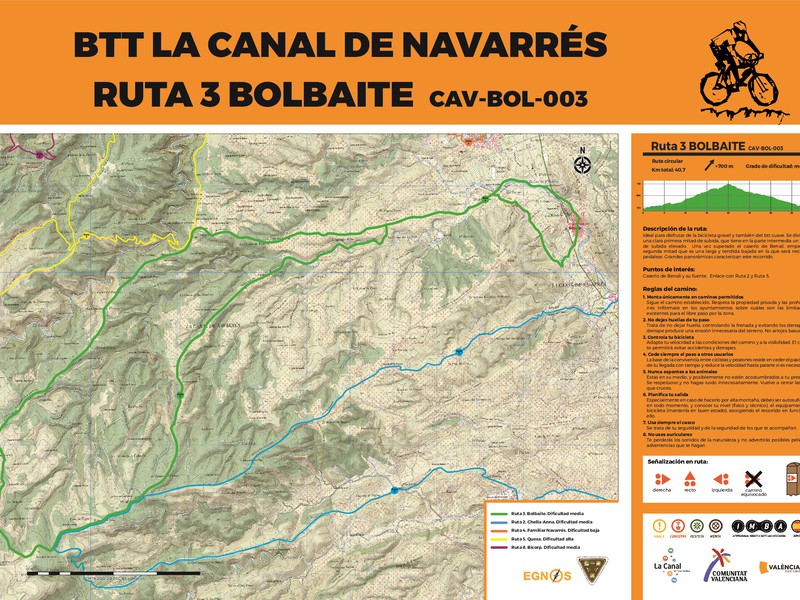
– Start: Bolbaite End: Bolbaite – Circular: Yes Direction: Clockwise. Can be done counterclockwise: Yes – Technical path or trail
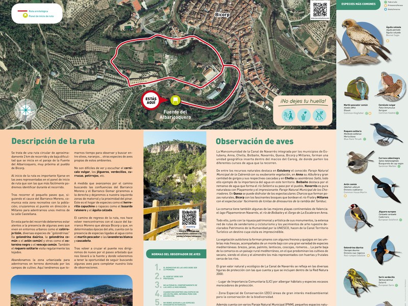
This is a circular route of approximately 2 km in length and low difficulty that starts at the site of
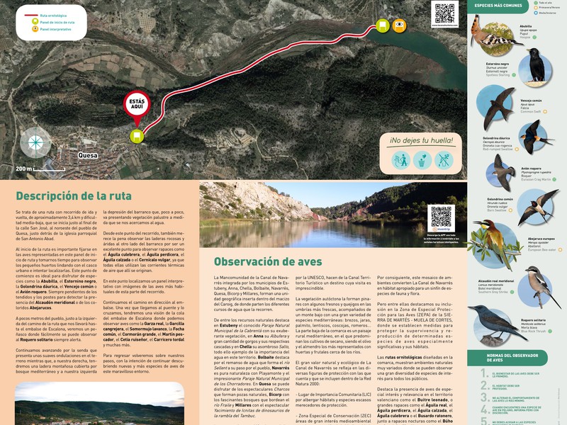
This is a round trip route of approximately 3.4 km with a medium-low difficulty level, starting just at the end
This is a circular route of approximately 3.5 km with low difficulty that starts south of the town of Navarrés,
SAFETY REGULATIONS The BTT itinerary in the Municipal Natural Area of Los Chorradores is shared with hikers, so precautions must
The Millares Springs Route is a beautiful and easy route that anyone can do without any problems. It is a
38.35 km Start: Tourist Info Anna / Moderate / Circular – Start: Anna End: Anna – Circular: Yes Direction: Clockwise.
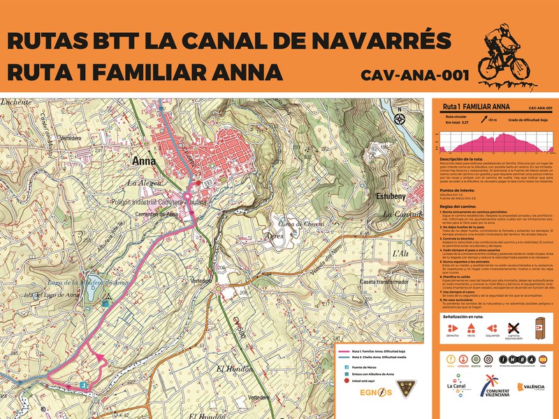
5.39 km Start: Tourist Info Anna / Easy / 30min. Circular CAV-ANA-001 – Start: Tourist Info Anna (https://goo.gl/maps/hGR8fYdwdobbdRNs9) – End:

Circular hiking trail that runs through the Barranco Salado, passing through the Cano cave, the Casa de los Picantes and
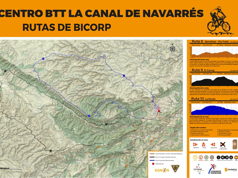
Circular mountain bike route of approximately 33km that runs along the Ludey River, passing through the Cueva del Moro, Las
Distance 70.92 Km Accumulated slope Ascent: 2,462 m Minimum altitude: 102 m.a.s.l. Maximum altitude: 1,126 m.a.s.l. (Caroche Peak) Approximate time: