BTT Cruz de la Ceja-Fuente El Pino
Very pleasant route, a 23 km ‘stroll’, ideal for gravel and gentle mountain biking. Without significant slopes, tracks in good
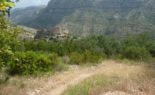
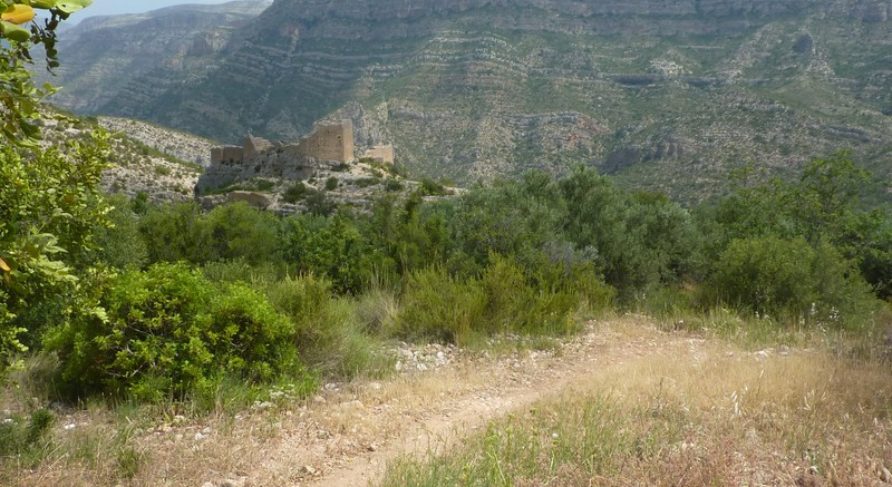
The Barraca de Tomás-Cingla de la Cava Route runs through the western end of the municipality of Millares, it covers a distance of 12.5 km and is of moderate difficulty.
It is a path of high landscape and environmental value, that climbs to the departure point of the Barraca de Tomás (706 metres above sea level, km 4.9), with an essential stop at Peña de la Mora (km 0.9), that rises from the void of the Nacimiento Ravine. Then, climbing up the winding path of Mal Paso, we head into the Barranco del Gorrino de Francia ravine, before leaving it and heading back up La Loma Larga to the Barraca de Tomás.
The path back runs along Los Majalicos de Jaime, before reaching the Poza de la Zorra pool, and then you head towards Cingla de las Cavas and can take the opportunity to visit Cueva de la Hiedra cave (km 6.7) which forms a large cavity directly below the Las Cinglas ridges. At this point the steep descent begins towards Fuente de las Cavas spring, where you can rest beside a pond and a walker’s hut. The path continues through the Rincón de Merino and Borrasca nature areas, goes round the Barranco de las Cavas ravine and the El Hondo ravine, until it reaches Las Eras, which presides over the upper part of the town, along the Cabos path.
Very pleasant route, a 23 km ‘stroll’, ideal for gravel and gentle mountain biking. Without significant slopes, tracks in good
With this route, you can explore the mountains of the Macizo del Caroig and the Muela de Cortes by bike.
Pay attention to the +1245 meters of elevation gain for less than 30 km. The first part offers spectacular views
Tour around the entire area of Chella. The first half goes through the eastern part until Km 8, where it
Copyright © 2023. La Canal de Navarrés. All rights reserved.
Do not hesitate to contact us for any further information.
This website uses cookies so that we can provide you with the best user experience possible. Cookie information is stored in your browser and performs functions such as recognising you when you return to our website and helping our team to understand which sections of the website you find most interesting and useful.
Strictly Necessary Cookie should be enabled at all times so that we can save your preferences for cookie settings.
If you disable this cookie, we will not be able to save your preferences. This means that every time you visit this website you will need to enable or disable cookies again.